Skokomish
River
1938 Aerial Photos
To Find and Download Orthophotos:
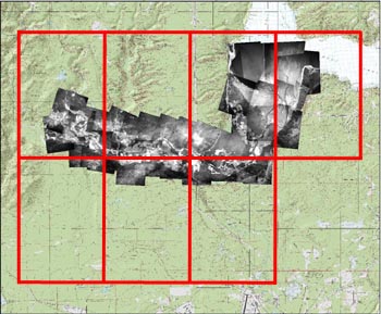
Select an orthophoto tile on the reference image (right). A close-up image will appear in a viewer window to the right, with links to download a full-sized, high-resolution version of the image.
This set includes 1938 air photos covering the Skokomish River. Data is organized and named by quarter quad (red grid at right) and is zipped into a UTM ZONE 10N NAD27 and a UTM ZONE 10N NAD83/HARN .zip file that includes a geo-tiff (.tif) and metadata (.html).
The reference image (right) shows the mosaicked orthophoto tiles draped over contemporary topographical maps and shaded relief.