We used archival and modern sources with a GIS to reconstruct the condition of tidal marshes in the Puget Sound region prior to Euro-American settlement (Figure 1). We used US Coast & Geodetic Survey maps ("T-sheets") surveyed between 1850 and 1890, supplemented with field notes and plat maps from the General Land Office survey, other early maps and aerial photographs, early text sources, and modern data, including high-resolution digital elevation models from lidar.
We used the reconstruction to inventory historical tidal marshes (inclusive of estuarine and tidal-freshwater wetlands) and develop a landform-based classification using several geomorphic, hydrologic, and oceanographic variables (Figure 2). We created 20 hierarchically organized tidal wetland types grouped at the broadest level into four categories: nearshore marine accretionary landforms, unembayed nearshore marine coastal marshes, embayed estuaries, and large river estuaries (Figure 3). Many of the wetland types cluster in the north or south Sound, reflecting differences in post-glacial sea level change and exposure to wave energy (Figures 4a–4h).
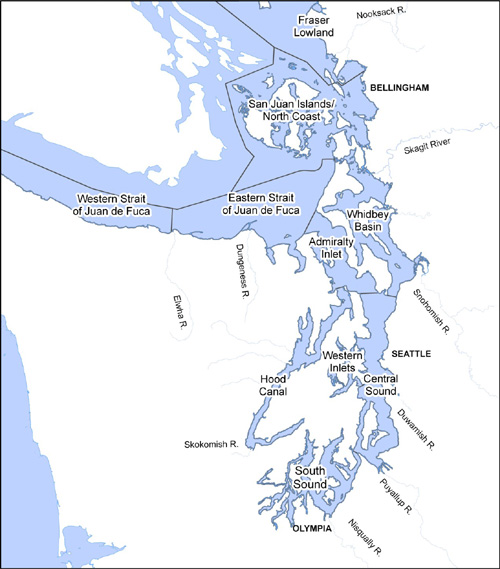
We identified 29,500 hectares of tidal wetland including 12,000 hectares of estuarine emergent marsh, 6,000 hectares of estuarine scrub-shrub wetland, and 11,500 hectares of tidal-freshwater wetlands. A retrospective inventory of pre-settlement tidal marsh made in 1884 agrees with our total estimate within 1-2%. Tidal marsh was heavily concentrated in the Whidbey Basin (Figure 5). The estuaries of large rivers accounted for 90% of the total (Figure 5) and for nearly all of the estuarine scrub-shrub and riverine-tidal habitats (Figure 6). Excluding major river estuaries, wetlands associated with accretionary landforms, such as cuspate forelands and spits, accounted for another 3% of the regional total, and barrier estuaries in arcuate embayments another 4%; both types cluster in the north Sound (Figure 7). Drowned glacial drainages accounted for the largest portion of tidal marsh in the south Sound.
The aggregate area of tidal wetlands is now about 17-19% of the historical amount, including wetlands created since the historical reference. About half of tidal marsh area is now concentrated in the greater Skagit River delta area, proportionately nearly as much as was historically (Figure 8) but major river estuaries today account for 80% of the total because of substantial declines in marsh area in several other river estuaries (Figure 9). Outside of the river estuaries, the relative proportion of wetland area has shifted both by type and region; some wetland types have diminished proportionately more than others, notably the large barrier marshes in the north Sound, and some sub-basins have lost proportionately more than others—the northern Sound and Central Sound sub-basins have the least historical wetland area remaining proportionally, and the Hood Canal, South Sound and West Strait sub-basins have proportionally the most (Figure 10). Individual wetlands have changed in their relative importance spatially and quantitatively from the historical condition (Figures 11a-11d).
A program to restore tidal marshes in Puget Sound needs to take into account the patterned diversity of tidal wetland types; biological assessments for restoring habitat for salmon and other endangered species, currently a motivation for nearshore restoration, need to account for changes to the spatial distribution and connectivity of habitats, as well as to their sizes and aggregate amount.
