Research
The Holocene geo-ecological evolution of river valleys and estuaries
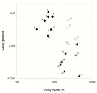
 Historical landscape reconstructions and topographic analyses are showing that Pleistocene glaciation and contrasting post-glacial fluvial response have created different river valley types with contrasting river morphology and dynamics, floodplain landforms, and riverine ecosystems.
River valley domains in the Puget Lowland.
Wood in the fluvial landscape
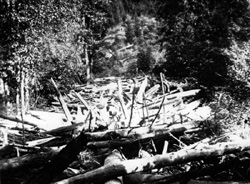
 A combination of field and archival studies characterize fluvial wood and its functions prior to the last century and a half of anthropogenic change (Collins et. al. 2002), and the dynamic between wood, river dynamics, and the floodplain forest in landscape evolution and ecosystem assembly.
Teanaway River. From Russell,
I. C. 1909. Rivers of North
America. Putnam, NY.
Mapping the historical landscape and landscape change
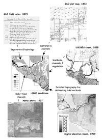
 With a GIS, we are using archival sources, lidar DEMs, and other modern sources, integrated with insights from process and archival studies, to map the physical and ecological landscape of river valleys and estuaries at the time of early Euro-American settlement.
For an application of historical mapping to an analysis of historical change to Puget Sound tidal marshes, see Collins and Sheikh (2005a).
Using multiple sources to map thehistorical environment (from
Collins et al. 2003).
Applications to resource restoration and management, and ecological assessment

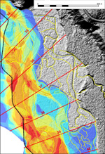
- Approaches to mapping channel migration zones in lowland rivers (Collins and Sheikh 2004b; 2004c)
- Developing a regional framework for river restoration (Collins et al. 2003)
- An approach to a linked river and riparian forest restoration (Collins and Montgomery 2002)
- Historical analysis to support restoration planning (e.g. Collins 2005)
- Habitat estimates for historical salmonid production assessments (Collins and Sheikh 2003)
River valley (from Collins and
Sheikh 2004b).
For a project overview, see also: Collins et. al. (2003).