Orthorectification for the River History Project
Orthorectification is the process of creating planimetrically true images of the earths surface which accurately represent the ground and its associated features. The Puget Sound River History Project's orthophoto maps consist of historical aerial photos (stored in TIFF format) which were orthorectified, mosaicked, and tiled to USGS topographic quarter-quads using ERDAS Imagine software. Registration sources were USGS Digital Ortho Quarter-quads and USGS 10-meter DEMs.
In the case of historical photos, expected accuracy of orthophotos can vary somewhat; older photo sets may be damaged, incomplete, over- or under-exposed, or otherwise difficult to interpret. Usually little or no camera information is available for older photo sets; while Imagine OrthoBASE readily and handily estimates such missing information, some accuracy is necessarily forfeited. Nonetheless, orthorectified aerial photographs typically have far better overall accuracy than conventionally georeferenced photos.
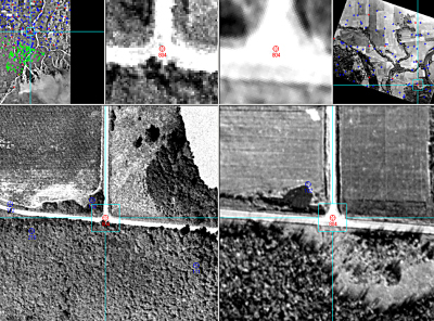
The most common difficulty in orthorectifying historical photos is that of finding enough ground-control points on an image. To make matters more difficult, many more ground-control points are necessary when working with images for which no camera information is available. Ground-control points are not always plentiful, and those that are available may not always be precisely interpretable. A building corner, for example, or the intersection of a sidewalk with a road, can be quite precise (within a meter, perhaps), while the center of a wide road intersection or a property corner in an agricultural area may require some interpretation and estimation on the part of the analyst. As another example, roads have often been widened during the period between, say, 1938 (the year a given historical aerial photo set was flown), and 1998 (when a Digital Ortho Quarter-quad reference source was produced); picking the center of an intersection in 1938 and 1998 is often by far the best control point available in the area in question, but still requires some interpretation and guesswork.
ERDAS Imagine's OrthoBASE software module (now called the "Leica Photogrammetry Suite") can almost always overcome such problems as outlined above to produce good data, even when control has been difficult to achieve. Photogrammetric modeling based on collinearity equations eliminates systematic and non-systematic geometric distortion most effectively, creating a more reliable geographically corrected image. Photogrammetry is unique in terms of considering the image-forming geometry (though in the case of historical photos with no camera-calibration information, image-forming geometry is largely estimated), using information between overlapping images, and explicitly dealing with the third dimension, elevation. As opposed to conventional geometric correction (georeferencing with polynomial transformation models), which deals with images one at a time, orthorectification provides an integrated solution for multiple images simultaneously and efficiently. It is very difficult, if not impossible, for conventional techniques to achieve a reasonable accuracy without an even greater number of ground control points (a task that is always painstaking and often nearly impossible); to accommodate images that have severe errors (systematic or non-systematic); or to accommodate images covering rough terrain. Misalignment is more likely when mosaicking such separately rectified images. The photogrammetric techniques used by ERDAS Imagine overcome the problems of conventional geometric correction by using an integrated and more accurate solution called a "least squares bundle block adjustment." Any error is identified, minimized, distributed, and even partly removed by the mathematical "bundle block" solution for the entire photo set, thus providing very reliable overall results.
Charles Kiblinger, July 13, 2004
References:
ERDAS LLC, Leica Geosystems GIS & Mapping, 2002. ERDAS Field Guide™ Sixth Edition. Atlanta, Georgia.
ERDAS LLC, Leica Geosystems GIS & Mapping, 2002. IMAGINE OrthoBASE® User's Guide. Atlanta, Georgia.